Select NOAA-NWS Forecast Office Text Products

(Product availability varies with seasons, forecast office, and weather.)

Daily Hydrometeorology for Columbia, SC

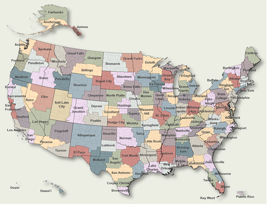
To Select Another NWS Office Click on Map or Choose from List

County Warning Area MAP
Select Forecast Office:   Select Product:  
060
SXUS52 KCAE 131515
HYDCAE
GAC033-073-181-189-245-SCC003-009-011-017-025-027-037-039-055-057-061-
063-065-071-075-079-081-085-141515-

Daily Hydrometeorological Data Summary
National Weather Service Columbia SC
1115 AM EDT Tue May 13 2025

.BR CAE 0513 ES DH07/TX/TN/TA/PPP/TSIRZX/TSIRZN/TSIRZ/EP
:
:Max...High Temperature last 24 hrs min...Low Temperature last 24 hrs
:Cur...Temperature at Observation....Pcpn...Precipitation last 24 hrs
:Evaporation in inches
:
:                                       Air Temp                      Soil Temp
:Station               SID    Max    Min    Cur    Pcpn    Max    Min    Cur    Evap
:
:...Northern Midlands...
:Bishopville         :BSPS1    74/    67/    67/   0.40/      /      /      /
:Jefferson 0.1 NW    :JEFS2    72/    65/    66/   0.77/      /      /      /
:Little Mountain     :LIMS1    70/    64/    67/   0.37/      /      /      /
:Lugoff              :LUGS1    73/    67/    68/   0.41/      /      /      /
:Newberry Coop       :NWYS1    71/    64/    66/   0.43/      /      /      /
:
:...Central Midlands...
:Batesburg           :BATS1    71/    56/    67/   0.79/      /      /      /
:Cedar Creek         :BLYS1    73/    65/    67/   1.45/    71/    71/    71/
:Columbia Airport    :CAE      76/    68/    70/   1.37/    70/    69/    70/
:Mcentire Ang        :MMT      78/    69/    71/   0.24/      /      /      /
:Owens Field         :CUB      78/    68/    70/   0.57/      /      /      /
:Pontiac             :PTCS1    74/    67/    68/      M/      /      /      /
:Saluda              :SADS1    71/    63/    66/   0.58/      /      /      /
:Shaw Air Force Base :SSC       M/     M/    70/   0.27/      /      /      /
:St. Matthews        :SMWS1    74/    68/    68/   0.29/      /      /      /
:Sumter              :SMRS1    74/    68/    69/   1.02/      /      /      /
:Swansea 3.5 NE      :SWAS1    74/    67/    67/   1.12/      /      /      /
:
:...Southern Midlands...
:Bamberg             :BAMS1    74/    68/    70/   0.22/      /      /      /
:Manning Coop        :MANS1    73/    63/    67/   0.77/      /      /      /
:Orangeburg          :OGB      76/    68/    69/      M/      /      /      /
:Salley              :SLYS1    73/    66/    69/   0.85/      /      /      /
:
:...Central Savannah River Area...
:Aiken               :AKIS1    73/    64/    67/   1.50/      /      /      /
:Augusta Bush Field  :AGS      74/    61/    66/   0.90/      /      /      /
:Augusta Daniel Field:DNL      73/    64/    67/   0.73/      /      /      /
:Barnwell 5 ENE      :BNLS1    77/    65/    72/   0.11/    64/    62/    64/   0.07
:Clarks Hill Lake    :CHDS1     M/     M/     M/   0.42/      /      /      /
:Graniteville 1.2 NE :GNTS1    72/    64/    67/   1.10/    70/    67/    68/      M
:Johnston            :JOHS1    72/    61/    66/   1.39/      /      /      /
:Lincolnton          :LNCG1    74/    64/    65/   0.74/      /      /      /
:Mccormick           :MCCS1    75/    64/    64/   0.74/      /      /      /
:N. Augusta          :NAGS1    73/    63/    63/   3.05/      /      /      /
:Thomson             :THMG1    79/    62/    71/   0.38/      /      /      /
:Waynesboro          :WYNG1    76/    63/    66/   0.17/      /      /      /
.END
:
:
.BR CAE  0513 ES DH00/TX/TN/TA/PPP/
: Orangeburg Water Plant data are from midnight to midnight.
:
:Orangeburg            :ORBS1   73/   67/   67/   1.54
: Fairfield Pump Storage data is from midnight to midnight.
:
:Fairfield Pump Storage:PASS1     /     /     /   1.60
.END
:
: NWS precipitation only stations
:
.BR CAE  0513 ES DH07/PPP
:Lincolnton         :LNCG2   0.51
:
: USGS Rain Gage stations
:
:Blackville Clem.   :BLVS1   0.48
:Chesterfield       :CSFS1   1.09
:Congaree NP RAWS   :GDNS1   0.24
:Edgefield          :EGFS1   0.47
:Jefferson          :JEFS1   1.46
:Kiokee Cr. Evans   :EVNG1   0.28
:L. G. Chappells    :LGRS1   0.44
:Lake Murray Dam    :MURS1   1.37
:Long Cane          :LCRS1   0.50
:McTier Cr. Monetta :MCTS1   0.65
:Mcbee Precip       :MBES1   1.12
:Newberry           :NEWS1   0.30
:Pageland           :PAGS1   1.17
:SC Dot Saluda      :SRGS1   0.54
:Santee St. Pauls   :SPLS1   1.03
:Savannah Butler Crk:NSLG1   1.03
:USFS near Jackson  :SRSS1   0.37
:Waynesb. Girard    :GIRG1   0.40
:
.END
:
: NWS precipitation only stations from midnight to midnight
:
.BR CAE  0513 ES DH12/PPP
:Lake Wateree       :WATS1   0.00
.END

$$

Previous Daily Hydrometeorologys may be found at
NWS Columbia, SC (CAE) Office Daily Hydrometeorologys.
(Click 'Previous Version' there to view past versions successively.
Some may differ only in time posted.)

San Juan, PRHonolulu, HI Lake Charles, LA Pueblo, CO Corpus Christi, TX St. Louis, MO Reno, NV Raleigh, NC  Newport/Morehead City, NC Dodge City, KS Houston/Galveston, TX San Joaquin Valley/Hanford, CA Louisville, KY Fort Worth, TX Pittsburgh, PA Austin/San Antonio, TX Sacramento, CA Jackson, MS Phoenix, AZ Northern Indiana, IN Flagstaff, AZ Tallahassee, FL Springfield, MO Riverton, WY Blacksburg, VA Sioux Falls, SD El Paso Area, NM Columbia, SC Wilmington, NC Greenville-Spartanburg, SC Eureka, CA Midland/Odessa, TX Tucson, AZ Goodland, KS Huntsville, AL Amarillo, TX Norman, OK Lubbock, TX Marquette, MI Little Rock, AR Pendleton, OR Missoula, MT Binghamton, NY Boston, MA Green Bay, WI Billings, MT Baltimore/Washington San Diego, CA Tampa Bay, FL Morristown, TN Twin Cities, MN Brownsville, TX Portland, OR Des Moines, IA Memphis, TN Pocatello, ID San Angelo, TX Jacksonville, FL Aberdeen, SD Quad Cities, IA/IL Charleston, SC New Orleans/Baton Rouge, LA Peachtree City, GA Shreveport, LA Grand Rapids, MI Medford, OR Albany, NY Wichita, KS Gray/Portland, ME Spokane, WA Boise, ID Denver/Boulder, CO Great Falls, MT Caribou, ME Key West, FL Miami-South Florida, FL New York City/Upton, NY Melbourne, FL Hastings, NE Paducah, KY Glasgow, MT Bismarck, ND Charleston WV Omaha/Valley, NE Buffalo, NY Jackson, KY Kansas City/Pleasant Hill, MO Gaylord, MI Cheyenne, WY Grand Forks, ND Detroit/Pontiac, MI Central Illinois, IL Burlington, VT Salt Lake City, UT Topeka, KS Nashville, TN Milwaukee/Sullivan, WI Albuquerque, NM Las Vegas, NV Wakefield, VA La Crosse, WI Birmingham, AL Los Angeles/Oxnard, CA Chicago, IL Seattle, WA Rapid City, SD Indianapolis, IN Philadelphia/Mount Holly, PA Mobile/Pensacola State College, PA Cleveland, OH Elko, NV Wilmington, OH Grand Junction, CO North Platte, NE Tulsa, OK San Francisco/Monterey Bay Area, CA Duluth, MN Anchorage, AK Fairbanks, AK Juneau, AK Tiyan, GU

Products Courtesy of NOAA-NWS
NWS Information Parsing Script by Ken True at Saratoga Weather - WFO and Products Scripts by SE Lincoln Weather.
Mapping by Curly at Michiana Weather and by Tom at My Mishawaka Weather.